


![the result of the simulation in the transport model expressing the car traffic load on the Kraków street system [vehicles/h], according to the Kraków Traffic Model](https://cdn.architekturaibiznes.pl/upload/galerie/207825/images/kadr12/fit/730x480/the-result-of-the-simulation-in-the-transport-model-expressing-the-car-traffic-load-on-the-krakow-street-system-vehicles-h-according-to-the-krakow-traffic-model-431100.jpg)
![the result of the simulation in the transport model taking into account passenger flows [pas./h], according to the Krakow Traffic Model](https://cdn.architekturaibiznes.pl/upload/galerie/207826/images/kadr12/fit/730x480/the-result-of-the-simulation-in-the-transport-model-taking-into-account-passenger-flows-pas-h-according-to-the-krakow-traffic-model-431101.jpg)
![A traffic grid showing from where and to where the residents of Krakow are moving [os/d], according to the Krakow Traffic Model](https://cdn.architekturaibiznes.pl/upload/galerie/207827/images/kadr12/fit/730x480/a-traffic-grid-showing-from-where-and-to-where-the-residents-of-krakow-are-moving-os-d-according-to-the-krakow-traffic-model-431102.jpg)
![Turning relations at selected intersections in Krakow [poj/d], according to the Krakow Traffic Model](https://cdn.architekturaibiznes.pl/upload/galerie/207828/images/kadr12/fit/730x480/turning-relations-at-selected-intersections-in-krakow-poj-d-according-to-the-krakow-traffic-model-431103.jpg)
![The result of simulation in the transport model by individual means of transport [pas/d], according to the Krakow Traffic Model](https://cdn.architekturaibiznes.pl/upload/galerie/207829/images/kadr12/fit/730x480/the-result-of-simulation-in-the-transport-model-by-individual-means-of-transport-pas-d-according-to-the-krakow-traffic-model-431104.jpg)
![Load on individual streetcar and bus stops [lane/d], according to the Krakow Traffic Model](https://cdn.architekturaibiznes.pl/upload/galerie/207830/images/kadr12/fit/730x480/load-on-individual-streetcar-and-bus-stops-lane-d-according-to-the-krakow-traffic-model-431105.jpg)

![the result of the simulation in the transport model expressing the car traffic load on the Kraków street system [vehicles/h], according to the Kraków Traffic Model](https://cdn.architekturaibiznes.pl/upload/galerie/207825/images/kadr17/fit/117x97/the-result-of-the-simulation-in-the-transport-model-expressing-the-car-traffic-load-on-the-krakow-street-system-vehicles-h-according-to-the-krakow-traffic-model-431100.jpg)
![the result of the simulation in the transport model taking into account passenger flows [pas./h], according to the Krakow Traffic Model](https://cdn.architekturaibiznes.pl/upload/galerie/207826/images/kadr17/fit/117x97/the-result-of-the-simulation-in-the-transport-model-taking-into-account-passenger-flows-pas-h-according-to-the-krakow-traffic-model-431101.jpg)
![A traffic grid showing from where and to where the residents of Krakow are moving [os/d], according to the Krakow Traffic Model](https://cdn.architekturaibiznes.pl/upload/galerie/207827/images/kadr17/fit/117x97/a-traffic-grid-showing-from-where-and-to-where-the-residents-of-krakow-are-moving-os-d-according-to-the-krakow-traffic-model-431102.jpg)
![Turning relations at selected intersections in Krakow [poj/d], according to the Krakow Traffic Model](https://cdn.architekturaibiznes.pl/upload/galerie/207828/images/kadr17/fit/177x146/turning-relations-at-selected-intersections-in-krakow-poj-d-according-to-the-krakow-traffic-model-431103.jpg)
![The result of simulation in the transport model by individual means of transport [pas/d], according to the Krakow Traffic Model](https://cdn.architekturaibiznes.pl/upload/galerie/207829/images/kadr17/fit/177x146/the-result-of-simulation-in-the-transport-model-by-individual-means-of-transport-pas-d-according-to-the-krakow-traffic-model-431104.jpg)
![Load on individual streetcar and bus stops [lane/d], according to the Krakow Traffic Model](https://cdn.architekturaibiznes.pl/upload/galerie/207830/images/kadr17/fit/177x146/load-on-individual-streetcar-and-bus-stops-lane-d-according-to-the-krakow-traffic-model-431105.jpg)

Public Architecture
For more articles on similar topics, see A&B issue 02/2024 - PUBLIC ARCHITECTURE,
from which we publish the article below. Download free e-issues of A&B and read more.
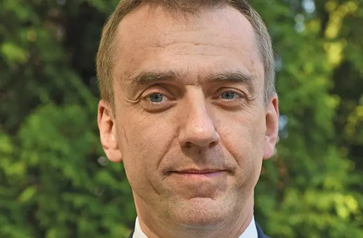
For several decades there has been a discussion about the role of public transportation in the city and the reduction of car traffic. We know all the arguments for and against. We even have a World Car Free Day as part of the popularization of healthy lifestyles, and a clean air policy has resulted in free use of Krakow's public transportation on days with high levels of smog pollution. Professor Andrzej Szarata, rector of the Cracow University of Technology, talks to Małgorzata Tomczak about how efficient transportation is now being designed, and how to use data from apps and payment cards.

Andrzej Szarata: Professor, Rector of the Cracow University of Technology. Since 2016, Dean of the Faculty of Civil Engineering at PK. Author and co-author of several monographs (including in English) and more than 90 articles. Organizer of scientific and technical conferences. Manager of PK projects, among others: Civitas Caravel, MAX, Shape-It, TraCit, Posmetrans, GSP, Capital. Author of transportation models for Polish cities; co-author of the transportation model of Thessaloniki (Greece). As a consultant in the field of transportation, he works both at home and abroad. He is a member of the scientific and organizational team of the regular European Parking Conference and a reviewer of scientific publications in domestic and foreign journals. He participates in transportation projects (more than 200) related to the study of functional efficiency of transportation investments.
Data in transportation design
Malgorzata Tomczak: Professor, you are the rector of the Cracow University of Technology, but your main occupation is transportation design, can I say that?
Prof. Andrzej Szarata:I'm a civil engineer and road engineer by training. But at the beginning of my career, I started to deal with traffic forecasting, so in fact I became a transport planner. I am involved in analyzing the transportation system, development directions and assessing the functional efficiency of large infrastructure investments.
Malgorzata Tomczak: There is a lot of talk now about intelligent transportation. What is it?
Prof. Andrzej Szarata: Intelligent transportation responds to the current transportation needs of its participants, and it does so in real time, with up to the minute accuracy. For example, if there is a car breakdown at intersection X that blocks traffic, an intelligent traffic light system will come to the rescue. It is able to direct traffic in such a way that the loss of time for the remaining drivers is as small as possible.
Malgorzata Tomczak: And in public transportation?
Prof. Andrzej Szarata:For public transportation, it's a matter of optimizing the system as a whole. An intelligent transportation system means that we can adjust public transportation services to the current needs of city residents in such a way as to optimize travel times. This is the main advantage of this type of solution. With them we want to save the time that public transport passengers have to spend on travel. We're all about making public transportation simply effective and most efficient.
![wynik symulacji w modelu transportowym wyrażający obciążenie ruchem samochodowym układ ulic Krakowa [poj/h], według Krakowskiego Modelu Ruchu](https://cdn.architekturaibiznes.pl/nowebp/upload/galerie/207825/images/fit/1100x0/0e555c9cbed32e4eb8bcc30c8de6d381.jpg)
The result of the simulation in the transport model expressing the traffic load of the Krakow street system [poj/h], according to the Krakow Traffic Model
© Andrzej Szarata
Malgorzata Tomczak: What is transportation design for the city today? What tools are being used?
Prof. Andrzej Szarata:With current technological capabilities, the decision-making process when planning the transportation system is increasingly based on hard data. In the past, this process was based primarily on the competencies of the planner - knowledge, experience, intuition. Today, when we have access to large data sets and can use computers with enormous computing power to analyze them, we are able to accurately select information from many different sources that will be useful to us in the transportation system planning process. Nowadays, this could be anonymized data on cell phone log-in locations or on where and when credit card transactions take place. However - along with IT tools - talking to people is still a very important element. When planning transportation for cities and regions, so-called Comprehensive Traffic Surveys, or KBR for short, are performed. They concern the mobility behavior of residents. Krakow has done such a study in 2023, and we are waiting for the results to be published. KBR surveys involve a trained interviewer being sent to randomly selected households and asking residents how they moved on the day before the survey. He asks what time a person left for work, what he drove, whether he shopped and where, what was his sequence of movements during the day.
In this way, we collect information about entire travel chains. In Krakow, more than 20,000 interviews were conducted with residents during the last such survey. This is a large research group, and analyzing its transportation behavior will allow us to get a really good mapping of what residents expect to move around Krakow. However, the information they provide in their interview with the interviewer will not be sufficient for designing the transportation system. They are fraught with certain limitations. First, for a variety of reasons, interviewees do not always present their trips exactly as they actually were. Second, they don't fully understand the need for this design and sometimes keep quiet about certain things because they don't know they are important. And this in turn could distort the result, hence the need to supplement the data from this source with others. However, the KBR research is still an extremely valuable source of information, for Krakow all the more valuable because it has been conducted here since the 1970s. Thanks to such a long time perspective, we can compare trends, analyze how they have changed over the past twenty, thirty years. On this basis, we can use mathematical methods to model the transportation behavior of residents (even in the future), with the idea that since people travel like this now, it is likely that in the future their trips around the city may look similar. It happens, however, that the accuracy of such predictions is affected by an unexpected factor. Such a factor in recent times has been the pandemic. It had a huge impact on transportation behavior, it greatly disrupted the traditional chain of travel. Until now, we had such a situation that residents would go to work at, for example, 7 a.m., return at 3 p.m., that is, we had peak traffic in the morning and afternoon. At the moment, we have high levels of congestion on Monday, and on Tuesday traffic is smooth. And a week from now, traffic jams will be on Tuesday, and there will be none on Monday. Complete unpredictability! And it comes from the fact that during the pandemic different work models emerged and stayed with us - now a large part of people work in a hybrid way, stationary and remote. This unpredictability makes it very difficult to manage the transportation system. This makes it all the more necessary to reach for additional data and tools for transport system planning.
![wynik symulacji w modelu transportowym uwzględniający potoki pasażerskie [pas./h], według Krakowskiego Modelu Ruchu](https://cdn.architekturaibiznes.pl/nowebp/upload/galerie/207826/images/fit/1100x0/291764122536288a8ddfeb1f62cdbf30.jpg)
The result of simulations in the transportation model taking into account passenger flows [pas./h], according to the Krakow Traffic Model
© Andrzej Szarata
Malgorzata Tomczak: Because the survey data are estimates and not precise enough?
Prof. Andrzej Szarata: Yes, reality may deviate somewhat from them. Here we come to the help of external data, for example, cell phone data. This is very interesting, because cell phone operators have been able to process data in such a way and present it in such a way for many years now that we can see exactly where thousands of cell phone users are moving from, to where. Telecommunications companies can, for use in transportation analysis, process this collective data and provide planners with important information. Such a spatial picture of where people are moving from, to where, is called a traffic tie. In work on transportation in a city, an analyst refers to what is called a traffic region. This is an area where, for example, a thousand people live. Krakow - for the purposes of transportation studies - has been divided into four hundred such regions. We assume that residents leave and come to these regions in a very similar way. And on this basis, transportation planners can make their analyses, using mobile data, with - an important caveat here - based on anonymized data on large groups of people. Neither you nor I would like someone to track our phones and know exactly that we drove between this hour and that hour in such and such an area. Telecom operators secure data in two ways: first, they do not analyze individual movements. Second, they don't process all phone logging signals. They make their data available for the purposes of transport planning in the relevant time frame we need in an aggregated way, referring to larger groups of movements. Only the data so generalized by the operators is processed, and we planners get it ready, in the form of tables. There is no way to isolate a single signal and arrive at information about the movement of a particular person. Mobile data has another great advantage. This is accurate data from the whole year, from day to day, hour to hour. This makes it possible to show exactly what this fluctuation of people's movements in the city over the year looks like: on Monday, Tuesday, Friday and so on.
![więźba ruchu obrazująca skąd i dokąd przemieszczają się mieszkańcy Krakowa [os/d], według Krakowskiego Modelu Ruchu](https://cdn.architekturaibiznes.pl/nowebp/upload/galerie/207827/images/fit/1100x0/721ca2c91addff6ebf6bbbc6e4f6734b.jpg)
A traffic tie showing from where and to where the residents of Krakow are moving [os/d], according to the Krakow Traffic Model
© Andrzej Szarata
Malgorzata Tomczak: Is such a database expensive? In other words, can cities afford to use them without problems?
Prof. Andrzej Szarata:Transportation system planning is a large and important task for cities. Among other things, it serves to assess the economic sense of spending on new transportation investments - in rolling stock or infrastructure. Such expenditures amount to millions, sometimes even billions of zlotys. It is worth basing decisions on the most accurate data possible. The cost of access to such a database is from tens to hundreds of thousands of zlotys, in my opinion it is a worthwhile expense. We talked about mobile network data, but here we still have some gaps in information. How to fill them? By using data fusion: for example, from mobile telephony and from surveys or from still other sources. Using data from payment card usage gives us additional possibilities. This is a completely innovative approach, which I proposed in the author's methodology for conducting research in the area of transportation planning. No one in the world has yet used this type of data in the way we do at the Cracow University of Technology, i.e. for transportation system planning.
Malgorzata Tomczak: How can payment transaction data be used for transportation planning? Is the confidentiality of card user data also protected here?
Prof. Andrzej Szarata: We have two big players in the world who are involved in digital payments: Mastercard and Visa. In Poland, Visa has a slightly larger market share, about 53 percent, which means that more than half of all credit card users pay with this card. Grouped data on payment locations and times can provide transportation planners with valuable information on the movement of large groups of people. The confidentiality of card users' personal data is protected here: digital payment operators only have the card number and nothing else to identify a specific user. In transportation analysis, we do not analyze individual transactions, but rely on anonymized, grouped data on transactions completed in a given traffic area. These are huge numbers of events, sorted into categories that can be useful to transportation planners. This is possible because virtually all payment card readers are geocoded, that is, they are assigned their XY coordinates. From each reader we can read: how many transactions there were, at what time, where and in which product group these transactions took place. This data is then grouped by the system into our traffic regions and we get data tables that can be a valuable supplement to other sources of information (for example, from surveys). On the fusion of this data, effective solutions can be built further. Why is this an innovative approach? Because this data has been used by Visa for a long time, but for other purposes, for example, to study tourism. I know that for Prague in the Czech Republic, analyses were done on where tourists come from. We also know the profiles of users, and this is a really great way to check the motivation of travel, which until now has been the least recognized.
![relacje skrętne na wybranych skrzyżowaniach w Krakowie [poj/d], według Krakowskiego Modelu Ruchu](https://cdn.architekturaibiznes.pl/nowebp/upload/galerie/207828/images/fit/1100x0/8c0a17c67fcaaac4b9efc11d90f4818d.jpg)
Turning relationships at selected intersections in Krakow [poj/d], according to the Krakow Traffic Model
© Andrzej Szarata
Malgorzata Tomczak: Why are these motivations being studied?
Prof. Andrzej Szarata:To ultimately create a tool that will map with mathematical equations the behavior of users in the city. At this particular moment, for 2023. We collect all this information from various applications, sources such as surveys, millions of mobile logins or millions of payment card transactions. We reinforce this data with information on the volume of ticket sales, measurements of the number of passengers or traffic volume, and from this whole conglomerate of information we build our forecasting tools. The developed transport model shows what the traffic volume is on the road and how many passengers are on a given section of the road network.
Importantly - we get information thanks to such a model not only about how many cars there are on a given street, we also know where these cars are coming from and that they are going down a particular street. If this street has to be temporarily closed for some reason, the program will show which way the vehicles will go around the closed street section. When we add, for example, Krakow's subway lines to our predictions, it will show how many passengers will transfer to it from other modes of transportation.
All these equations at the end give the number of passengers and cars on all sections of the road-street network in our city. Does the model work properly? We are able to easily check this by comparing the model's results with actual measurements on the transportation network. If we create the model so that it works well today, this will be the starting point for developing traffic forecasts for 2030, 2035 or 2050. When a city plans to implement a new infrastructure investment, we can predict what benefits this investment will bring to the city's residents in twenty, thirty, forty years.
![wynik symulacji w modelu transportowym w rozbiciu na poszczególne środki przewozowe [pas/d], według Krakowskiego Modelu Ruchu](https://cdn.architekturaibiznes.pl/nowebp/upload/galerie/207829/images/fit/1100x0/44432e2cca94914491844237856340d2.jpg)
The result of simulations in the transportation model by individual means of transport [pas/d], according to the Krakow Traffic Model
© Andrzej Szarata
Malgorzata Tomczak: It's a great tool to design transportation policy in the city and, for example, reduce individual car traffic in favor of public transportation.
Prof. Andrzej Szarata: Yes, that is what it is used for, among other things. It is also used for other activities related to city management and spending. For example, to assess what rolling stock to invest in - how many new streetcars and buses to purchase, to transport how many groups. In what parts of the city to expand transport infrastructure and how to do it - build a streetcar line, a road for buses, or perhaps a subway? Transportation models are also used to predict how a new investment will affect passengers' behavior, whether it will change their habits and needs, and if so, to which ones. We can predict how the exclusion of specific zones of the city from traffic, such as cars, will affect traffic in other parts of the city, and what new transportation needs of residents it will create.
Free public transportation?
![obciążenie poszczególnych przystanków tramwajowych i autobusowych [pas./d], według Krakowskiego Modelu Ruchu](https://cdn.architekturaibiznes.pl/nowebp/upload/galerie/207830/images/fit/1100x0/e37d4e001444a0f68a670f0edb69b118.jpg)
Load on individual streetcar and bus stops [pas./d], according to the Krakow Traffic Model
© Andrzej Szarata
Malgorzata Tomczak: Let's take another look at free transportation. Many cities are introducing it to reduce individual vehicular traffic.
Prof. Andrzej Szarata: How much does a monthly ticket in Krakow for all lines cost for a resident of Krakow?
Malgorzata Tomczak: PLN 80 per month in the first zone.
Prof. Andrzej Szarata:And how much do you spend per month on fuel for driving around Krakow?
Malgorzata Tomczak: More than PLN 500.
Prof. Andrzej Szarata:And how much does it cost you to insure your car, park in the paid parking zone, maintenance, tires, car wash, oil change and so on? These are thousands of zlotys. Compared to them, a ticket for public transportation is simply cheap. Only 80 zlotys for all lines is no cost in the budget these days. Would reducing this cost to zero cause people to choose the bus or streetcar more often instead of the car? They could already do so today, it would be financially very profitable. And yet they don't do it. Meanwhile, if we were to consider doing away with public transportation fees in Krakow, we have to realize two problematic things. First, the cost of maintaining transportation in the city would increase gigantically. Second, free transportation would not be respected. When something is free, it is not respected and slowly degrades. And what I am saying is not empty words. If it were otherwise, big cities in rich Western countries would have been doing this for a long time. There is no city with more than half a million residents that has introduced free transportation. There is no such thing in civilized cities, so talking about introducing free transportation in Krakow is simply a pipe dream. In small cities like Zory, Nysa, which have several bus lines, free lines can be implemented. But in my opinion, it won't really change much in the transportation habits of residents.
Malgorzata Tomczak: Thank you for the interview!